
Looking for Kateros - between a rock and a hard place
German friends who live part of the year on Nisyros had told me about an old settlement at Kateros, marked on the map; there was no path but it was just a question of picking your way around the mountain.
Gradually we were piecing together the footpaths. From the top of Mandraki just beyond the upper Temak machine where the narrow road ends we took the path leading right between fields, then turned right again up old stone steps up to join the stone path to Palaiokastro. We started up the road and veered right at the concrete water tank onto the kalderimi running below and parallel to it.

While following the kalderimi the
previous evening, we’d noticed it branched off downhill to the southwest, in the direction we wanted; it turned out to be well maintained and led to a few spiladia restored in
traditional fashion, with fences of natural wood. I suspected they
were foreign-owned, and sure enough we met a German woman.
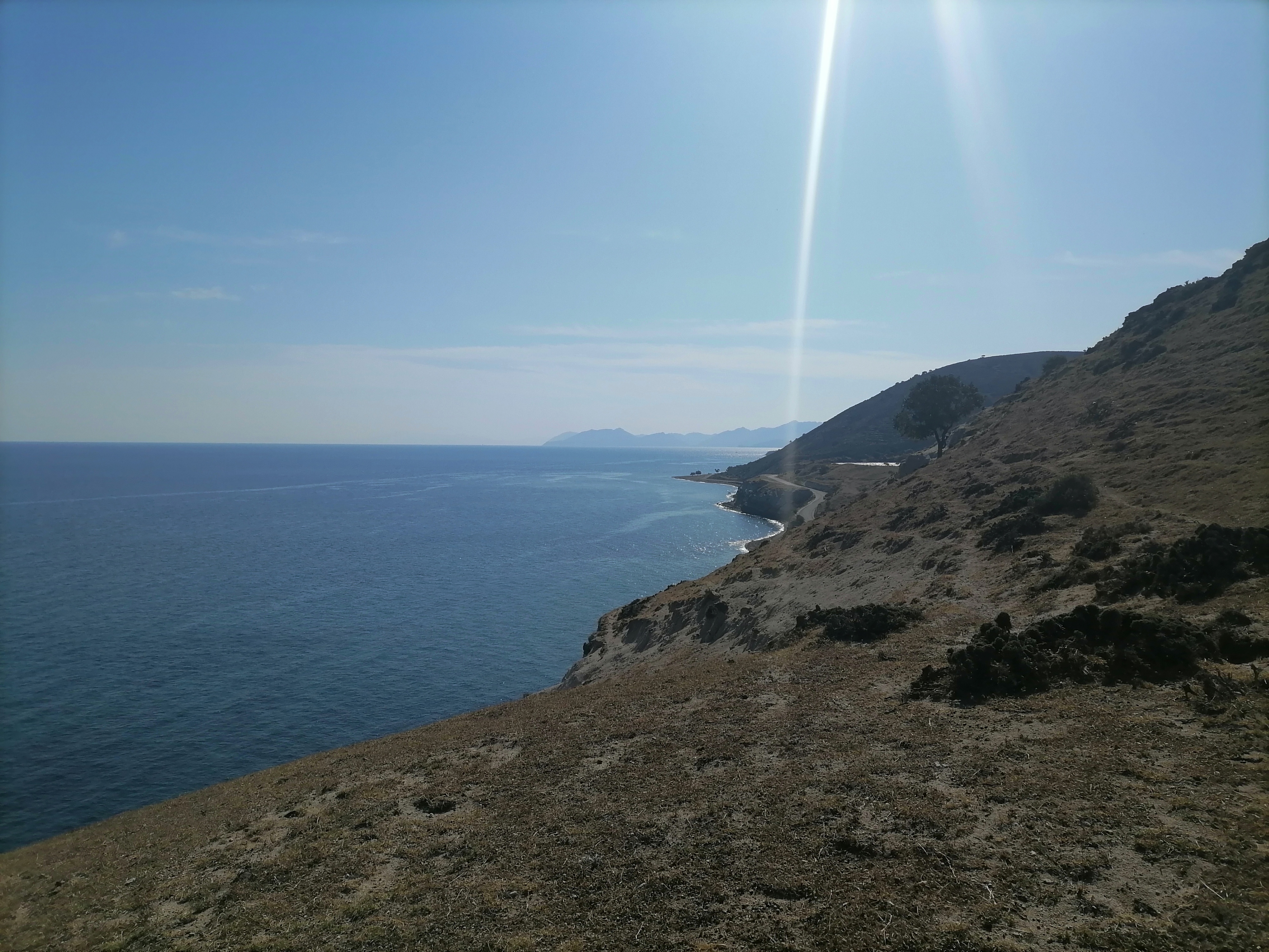
She said the path didn’t go any further than the houses, but we continued anyway, heading towards Karaviotis mountain.
Soon we were looking over the narrow valley, thick with trees and dotted with stone ruins, that leads down from Ayios
Zaharias (marked wrongly as Ayios Nikolaos on the Skai map?) to the sea. And a
red-dotted trail went down into the valley and up the other side. We took it as
far as a chapel to Ayia Marina; then the dots
seemed to rise a little then disappear. In the absence of any obvious landmarks, we simply headed around the mountain.


At last we came to a hidden, rocky valley, with traces of terraces. Trying to get a sense of the lay of the land, Lisa and I enthusiastically climbed up the other side of the valley, and found ourselves on an outcrop of strange, knobbly rocks.

This we negotiated for a while but until common sense seemed to dictate a retreat. Lisa, the hero, found a relatively easy way down, which emerged at the top of the valley just below a ruined building at around 400m.

While Ian went to look for a more sensible path forward, I explored behind the building, finding cave shelters with walls on the inside, notches in the rock face and post-holes for a gate, and stone troughs; and then, to my surprise, a deep shaft leading down below the rocks, with steps cut metres below, too far to reach without a rope or ladder. It seemed mysterious; though someone had been here recently, judging by scattered cigarette filters and a frappe coffee cup.
Then I noticed writing on the rock above: ‘H Dexameni ton Pyrgon’, the reservoir of the towers. Only the next day, seeing a different map, did I learn that this area is known as Pyrgi because of its ancient towers, part of a beacon system.
Ian returned with bad news about the way forward; given the dwindling daylight, finding Kateros and the way around the mountain would have to wait. We made our way upwards instead, both of us hoping the way back would be clearer…. And lo and behold, red and blue dots appeared and guided us on carefully laid rocks and over tricky rock fields, back to the church at the road.
There was a gleam of red in the sky as we made our way back towards Mandraki, then the sun began to fall beneath the layer of cloud, bright and pale behind streaks of red, then slowly sank into the sea. Of course, it was clear that to reach our goals we needed to set out earlier, and maybe camp overnight, which we couldn’t on this trip. Others might drive part of the way, but it seemed much more fun to be exploring as much as we could on foot, finding things along the way and getting to know the routes - the journey being as important as the destination.
Back in the room later, there was moonlight on the sea.
Rain and the windmill
Quiet morning with the power and water both off, just the sound of the sea in the harbour. I walked along the coast a short way, over the rocks in their beautiful ochres and rusts, crimson and brown. When sun came through the clouds I swam and found myself surrounded by a big group of long, slender fish close to the surface - loutsos perhaps, or large zargana; there were white trevally and grouper, flounder and flathead mullet and bream. The clouds came over again and the sea turned greyish and darker. The old guy who’d been fishing off the rocks went past on his scooter holding his rod, with a paint-bucket he used as a keep-net on the back.

It rained all afternoon, but later in a pause in the downpour, we risked a walk in the hills. I’d seen a red splodge on a rock on the road above the village indicating a route to the windmill. It turned into a fascinating network of old paths that branched and branched between terraced farms for kilometres.
Each old farm had its stone buildings, its trees
and cisterns and threshing circles, gently curving terraces, sheltered of a
fold in the hillside; amazing that such places were
abandoned. We came upon a chapel with a
wick burning in a bowl of oil – but we saw only goats and sheep. Below on the
coast road there was a blaring of horns from the wedding entourage – the son of
the owner of a taverna was marrying the daughter of the owner of a supermarket. Rain is a good thing, so fingers
crossed it was auspicious.
The path started breaking up; we found our way back along terraces to meet the road that wound down above the village, passing the football pitch. During an hour at the archaeological museum this morning, I’d learned it was when they were digging to build this in the 1980s that they started to find remains of funerary cremations dating from the eighth to the fifth centuries BC. People were buried with sophisticated pottery from around the Aegean and Phoenicia, modern Lebanon, as well as local pottery decorated with lions and sphinxes inspired by contact with the East. The dead were also left with foods to help on their journey – olive oil, wine, honey, figs, olives. Funny that they went ahead and put the football field on top of it, two and a half thousand years later.
As we reached town and descended the steps to the Old People’s Square, we passed the church with wedding tables laid out, and guests sheltering under shop awnings from the rain that was coming down again. By the sea, it was windy and cold. There would be music in the village that evening for the wedding, but – brrrrrr… I didn’t want wet feet.

Food Interlude
With walking so much, we worked up a huge appetite. But most restaurants were gradually closing for the season or had closed already. Still, less choice made things simpler.
On the seafront, Issikas was open for a few days but had wonderful chickpea fritters (known locally as pithia) and skordalia or garlic dip made with almonds, and herb-infused meatballs, which we washed down with lashings of cold red wine. Then we started going to Hochlaki, with friendly owners and similar very good food, plus local cheese, and vegetables baked in the oven. Vegos in the Old People’s Square did a fabulous salad with two different cheeses made by the owner, sakouliasti and a soft cheese, and good olives that weren’t mass-produced.
On the night of the cold and rain, I would have been happy to stay in and have raki and peanuts for dinner, but in the end we made it out as far as the first place, Aigaio, mostly a souvlaki and pizza takeaway but with a few high tables just behind the town beach. We ordered salads and souvlaki and chips and it was a feast fit for a king (who'd been walking for a week), and we drank enough cold retsina that we were soon singing along to the good old rock classics playing on the radio.

At midday it was breezy and sunny again,
rainclouds gone. Heading up from the Temak on the footpath veering left and
crossing the road, we looked for the continuing footpath. It was marked on the map so we wanted to give it another try, but as Vasilis had warned us it fizzled out fast. So we hiked
up terraces again, not stopping this time but hoping to find Armas quickly and head
across to the road to Evangelistria. We ended up way too high and
had to scramble back down a steep slope...
From the clear signpost at Evangelistria, the beginning of the old footpath to Emborio seemed to lead over a mess of rocks through a sheep farm and there were a few unclear sections. But before long, we came to the stone-built cistern and ruin of a house built of red rock in the side of the hill, and from there on it was clear and beautiful, with some amazing lava formations towering above, and the lush valley below. The little square of Emborio on a sunny Sunday afternoon in October was packed with taverna tables.


Instead of lingering, we looked for the path down to the caldera floor, or Lakki, and found it via an alleyway not far above the square. Despite some rough sections thanks to building rubble and fallen walls and so on, it was a superb, wide, black-stone path that wound down gently to the caldera floor, with a few ruined houses and a chapel.

It continued beyond the road into farmland, but we were looking for the start of the path that would take us up between the steep hills
of Boriatiko Vouno and Nyphios. This was the path I'd done four years ago from the other direction. Alas, I got the start slightly wrong, misled by an old
Geopark sign which I thought indicated a walking route but actually just
pointed out a geographical feature… However, we scrambled up the scree without
too much trouble, knowing there was a good path on the other side of it, and
followed that all the way back to Evangelistria in lovely afternoon light.


It had been a splendid afternoon of walking in sunshine, and with a little daylight left we tried our luck with a path downhill marked ‘Man’ for Mandraki. It fizzled out to nothing quite quickly. In fact, the Skai map does indicate that, but often at the end of the day there wasn’t much time or patience to study it. As we climbed down broken terraces in the dusk again, sure we'd cross one of the little paths from the previous day, monopati-fog clouded my brain. I'd lost track of what was where. But we made it down to the coast via a wired-up gate, just five minutes from home.
Big salads and souvlaki were calling again. Back at Aigaio, the owner was extremely busy but offered us a retsina on the house. He was a Nisyrian who’d spent decades in the US before taking on this business. ‘Four more years,’ he said, before he would retire and spend his days fishing.


Profitis Ilias
In the morning, in the museum I marvelled at the perfection of the Early Bronze Age (2700-2410 BC) cups found in Mandraki and a smooth clay hanging bowl from the fourth millennium BC found in Emborio. Most areas of Nisyros haven’t been excavated. It's only in recent decades that building or ploughing has revealed cemeteries spread over a wide area, spanning many centuries. After the early cremation burials came burials in pithoi jars and later by built graves with marble reliefs.
The nearby island of Yiali, now
mined for pumice used in building materials, was inhabited from the fourth
millennium BC, principally in the areas where obsidian was found – the black
volcanic glass an important material for cutting tools. There’s evidence
of stock raising, agriculture, fishing and seafaring, and crucibles for melting
copper. Yiali obsidian can be identified by the white flecks it contains – as
does the piece I found a piece on a hillside near my house. The smooth hard egg-shaped
grindstones of black and grey andesite identified as Final Neolithic appeared
similar to ones in my garden.

We’d been here just over a week and planned to leave the next day. It was time to get to the top of the island, Profitis Ilias. At lunchtime, we walked the road up to Evagelistria, then the same beautiful path up Diavatis we’d taken when we went to Nyphios, but turning right and continuing uphill. A Greek man was on his way down - the first person we'd seen on a footpath! - and reassured us it wasn’t far. It was steep but thanks to the excellent path, surprisingly easy. We reached an old chapel and a few ruined buildings with big trees and abandoned terraces, and from there markers vaguely led the way to the trig point at 698 metres.


It was a broad summit covered in once-farmed uplands, the surrounding valleys mostly hidden; but there were magnificent views to blue sea in every direction, the waves turning silver when caught by the wind and surging around little islets. Kos was clear to the north, the Knidos peninsula of Turkey to the east and Tilos to the south. The wind was cold on the peak so we hurried down again, stopping to investigate the start of an intriguing blue-dotted path leading off in another direction...


We’d made it to the top and it was a simple walk back down to Mandraki, where waves were crashing on the shore at sunset. But I still had a hankering to spend some time at Lies beach, and the weather forecast was good for tomorrow. And Ian had a hankering to explore another route to Profitis Ilias, the one we’d started on the first day. So we’d stay one more day.


Lies and Panayia Kyra
I set off just after
ten, walking along the coast road with Lisa and letting her into the sea for a
dip every now and then as the day was warming up. There wasn’t too much traffic
and it was lovely in the sunshine, though it
was a real pleasure to leave the main road and descend to peaceful Palli. Except
for a handful of people from a yacht having a late breakfast, it was quiet.
Cats were having a late breakfast too, eating whole fish outside the bakery. We
passed the grand old Pantelidis Baths, with the Roman church of Panayia
Thermiani behind it.
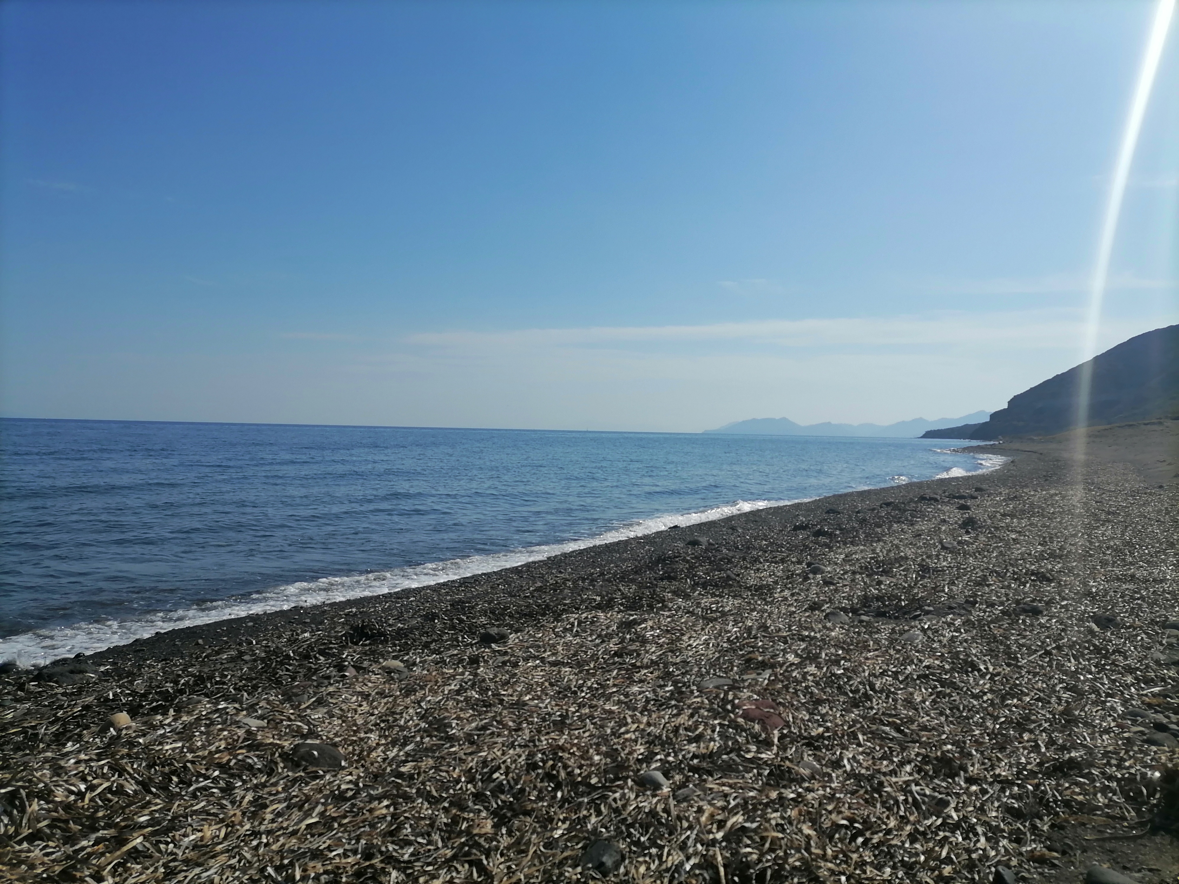

When we reached Lies, after a couple of hours of easy walking around the coast, Lisa rolled in the dry
seagrass, ecstatic – we hadn’t had much beach time this week. I found a
beautiful spot, relaxed (once the flies stopped biting…), and swam with my mask
to see the rising streams of pearly bubbles from breathing holes in the seabed.
There were still a few rental cars around, but the sun was warm and it was blissful to lie there and read, cooling off from time to time in the water.
There was still a chance to walk another route home. From the end of the road, I found a track that came to a stop but I scrambled up the slope to another track, winding my way up to Panayia Kyra in the peace and quiet, elated by the landscape as Pachia Ammos came into view far below and I came across old buildings and paths and scanned the ground for pottery.


Ascending into that old landscape, I thought about the joys of walking on history. When I reached the monastery and the track turned into dull white concrete, with no obvious sign of the trail that was marked on the map, I instead picked my way up gentle terraces until I found an old path, overgrown in places, that took me most of the way to the road.
From there it was just a question of following the quiet road - passing a worrying new construction site, alas - until the final bend towards Emborio, were I veered up the shortcut stone path; from the village we took the path along the ridge we’d done the other day back to Evangelistria.

Losing the daylight, from there we took the road zigzagging down, but on the final curve I found the lovely footpath back around the windmill to town. We were only ten minutes behind Ian, who had also achieved his goal and found the blue-dotted trail all the way from near Stavros monastery to Profitis Ilias.
*
The wild and untouched places on these islands are precious. Once you destroy a place, once you build a road, a hotel, it will never be the same again, it's lost forever. It’s something we’ve been thinking about on Tilos, where plans are in progress to concrete the road to Skafi beach, much loved only because of the beautiful route to get there, and the feeling of remoteness. A new road to Mikro Horio has left a big concrete scar across the hillside. There are plans to concrete the lovely, winding dirt tracks to Eristos.
If only the islanders got funding to maintain the centuries-old paths instead, how valuable they would be.
We hadn’t seen anyone else at all out walking except when we went to Profitis Ilias. I also realised I hadn’t had any interesting encounters with people. It must affect the local population, receiving such a volume of day-trippers every day whom they will see for a few minutes and likely never see again.
When I flick through the book of photographs by Peter Kuhne showing Nisyros of the previous four and a half decades, it’s unrecognisable. You’re hard pushed to find a magically cluttered and quirky old shop or kafeneio these days. Though one morning when I asked around for local honey, I was pleased to be directed to the electrical goods shop. All quirkiness is not lost.
On the last morning we went to the
ferry ticket office, and there were signs and leaflets for Anaema, the agrotourism organisation which organises walks; I asked about it and discovered the man at the next desk was a partner in it. And when I asked him about the blue-dotted trails that had
helped us so much, he smiled and said, ‘I made some of them.’ He and a few
locals were trying to revive the old paths. Perhaps we should have met him at the start of the trip... But then finding our way had been part of the fun, too.
As we waited for the ferry, Lisa seemed relieved that we were on our way home. But she'd loved her afternoons of hunting for paths, and her evenings of dinnertime treats. Perhaps she'll also be happy when we go back to explore some more.


